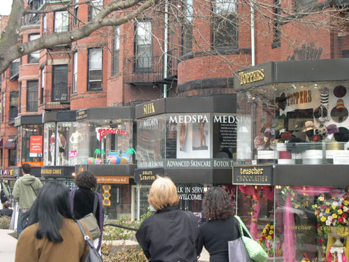
Does the presence of the Salvation Army in a prime downtown Framingham retail location hurt efforts to revitalize the downtown business district? Selectmen would like to move the organization out of its highly visible Concord Street storefront, according to the MetroWest Daily News. Supporters of local social service agencies are outraged, blasting the desire as trying to hide the poor and the fact that they need help. I understand the concerns of both sides, and suggest everyone take a deep breath here and try to think about what makes a good downtown business environment while also providing needed services to all in the community.
For a good shopping district, you want a critical mass of appealing storefronts. I don't think a massive, ground-level insurance or accounting office belongs on a prime shopping boulevard, and nobody's attacking the desirability of demographics of those clientele. What about the Salvation Army? Selectmen aren't trying to move them out of town, just out of their key downtown retail location. However, it's a fair question to ask whether they're also trying to move other businesses off that main shopping street - ones that don't target clients in need, but also don't fit well into a vision of a retail streetscape. It's also a fair question to ask the Salvation Army supporters whether it would truly hurt their mission if they were on a different but still accessible and visible street downtown.
There are three options here. 1) Encourage the Salvation Army to move to a nearby location out of prime retail space, probably by offering to buy their existing location as well as sell them a nearby one they find adequate for their needs. 2) Live with the Salvation Army as it exists on Concord Street. 3) Work with the Salvation Army to improve its existing facility - find a way to spiff up the exterior, and be willing to focus on their retail operation in their Concord Street windows. A nice, appealing second-hand store could conceivably work in a revitalized downtown. If more upscale shoppers are added to the mix of people populating downtown, and they're also encouraged to patronize the Salvation Army store with an attractive storefront, that makes it more likely the organization will end up with more donations of used clothing and such.
June 30, 2005
June 28, 2005
The Importance Of ‘Third Places’
A livable neighborhood has more than a place to live and a place to work. It's got another place - a third place, as CoolTown Studios explains, noting Ray Oldenburg's book on the topic -- an appealing community gathering place, not for official events, but to hang out. That's what Cheers was; that's what the Central Perk coffee shop and the diner were in Seinfeld. And that's another important anchor function the new library in Saxonville could have provided.
(aside: I hope all the shortsighted Town Meeting members who voted against the library, thinking that this year's snapshot-in-time financial situation was a good reason for making a decision that impacted 20+ years, saw the story in yesterday's Globe about how the state's financial problems have bottomed out, and revenues are on the upturn. By the time the library building affected our budget in a couple of years, state aid could be up. But these folks couldn't possibly see that over two decades, financial trends just MIGHT have changed....ARGH....)
Anyway, CoolTown Studios last week pointed to an outdoor beer garden of all things in the midst of Astoria, Queens (part of New York City). "By day it's welcome for kids and parents with a full Czech restaurant menu, and by night it's abuzz with gen xers and yers, accompanied by live bands on some weekends."
Of course, a Third Place doesn't necessarily have to serve alcohol. They can be cafes without alcohol, or even public squares. Shopping malls are the closest things to this in much of suburbia; but they can't touch the well-designed public square or street designed for strolling, lined with cafes, that much of Europe (and Montreal) enjoys for this function. (Photo below: Geneva's old town)
June 26, 2005
Randolph Zones For A Walkable Business District With A Sense Of Place
''We are looking at creating a walkable, pedestrian-friendly downtown and not a cement, automobile-driven strip of fast-food restaurants, banks, and liquor stores."--Michelle Tyler, member of Randolph's Master Plan Implementation Committee
Randolph Town Meeting recently approved a zoning change that would allow creation of a business district that would keep out "formula" fast-food chains, gas stations, and " other businesses that local leaders deem out of keeping with their vision of the downtown as Randolph's civic hub," the Boston Globe reports.
Town officials stress that they don't want to ban such businesses. However, they want control over the sense of place of the heart of downtown, and believe such businesses are a better fit just outside the town center.
At first glance, it looks like these officials understand that great downtown business districts don't simply happen by getting all the neighborhood storefronts rented. Someone needs to have a vision as to proper mix of retail and other businesses, and look & feel to encourage people to stroll and stay.
June 25, 2005
It’s Not Pedestrian Friendly If People Aren’t Walking
How can you tell if an area is pedestrian friendly? There's one easy and useful test: If you don't see people out regularly walking, something about the environment is causing people on foot to instinctively not use it.
There may be expansive sidewalks and official crossing lights, but that's not enough (Speen Street and Rte. 30 in Framingham are prime examples). There may be a large sweeping plaza for pedestrians (whether a park by the water in Cleveland or acres of cement in City Hall Plaza, as I mentioned a few days ago) that SHOULD be attracting people on foot but DOESN'T because it's poorly planned. If you see people aren't out there walking, something is wrong with the design.
Maybe it's the scale, and there's not the "sense of enclosure" pedestrians crave in a walking environment, either from properly sited buildings (not too far back) or good landscaping (a dense row of trees will do it). Perhaps it's a lack of any buffer between sidewalk and rushing traffic. Maybe in the case of a business district, the pedestrian crossings are too offputing.
Consultant Laura Hawks from the Renaissance Design Group spent three days in Fairfield, Iowa and noticed " plenty of people enjoying Central Park -- but most of them didn't cross the street to shop at the stores surrounding it," the Fairfield Daily Ledger reports. Bingo! Something's wrong with the design of the neighborhood.
Possible solutions? More prominent crosswalks, extending the sidewalks at intersections so the distance from curb to curb is less daunting, and wide, colored center strips to "provide a boulevard-like refuge for pedestrians crossing the street."
If you're ever tried to dash across the extraordinarily wide intersection at the end Leggat-McCall Connector and Rte. 30, you'll understand how important such things are. That intersection, and the lack of sidewalks on the south side of that intersection, are the main reasons why all the office workers out on foot in the area at lunchtime don't walk the few extra minutes to Shoppers World -- and why most don't even walk along Rte. 30.
June 23, 2005
How Can Parking Best Co-Exist With Pedestrian-Friendly Development?
One of the difficulties in creating a pedestrian-enticing streetscape in the suburbs is designing adequate parking that doesn't destroy on-foot ambiance. In cities like Boston and New York, population density is high enough, public transit is robust enough, and enough streets were designed before the emergence of our auto-centric culture, that walkable environments thrive. That's not the case in many other communities. A report from the Maryland Governor's Office of Smart Growth takes a detailed look at the dilemma and possible solutions:
The report examines a number of issues and potential ways of dealing with them, such as "design[ing] sites such that vehicles aren't the dominant feature." Note that the need for parking is clearly recognized, but it shouldn't overwhelm every other aspect of a project - as they clearly do in developments like the typical mall site, which aesthetically strikes people on foot as an unappealing sea of asphalt.
Thanks to Smart Growth Online for the link.
[O]ne of the biggest challenges facing smart growth is identifying new ways to address the need for parking while minimizing its negative impacts and encouraging better and different design. Parking is consuming a huge amount of land that could otherwise be developed. Surface and structured parking lots present sterile, unattractive environments that deaden city and suburban streets alike, further isolate uses and preclude lively pedestrian-friendly streets. Moreover, the adverse environmental impacts of parking lots, particularly on water quality, are increasingly recognized.
As developers attempt to meet the parking requirements of their projects, they find themselves beset with obstacles related to zoning, financing, and design, just to name a few. Parking requirements now drive many site designs, and are often the make or break issue for financing new developments. Too many quality smart growth projects remain on the drawing board because they simply cannot solve the parking dilemma. We need parking, but we need to re-think parking design, parking financing, and parking supply and demand to better meet the needs of communities, developers, and users. . . .
Multi-level parking garages in addition to being cost-prohibitive, often leave entire city blocks with little street level interest and activity. No one wants acres of pavement or dead gaps in the urban fabric, yet from the user’s perspective parking needs to be convenient, safe, and accessible, and from the developer’s perspective parking needs to be cost-effective.
The report examines a number of issues and potential ways of dealing with them, such as "design[ing] sites such that vehicles aren't the dominant feature." Note that the need for parking is clearly recognized, but it shouldn't overwhelm every other aspect of a project - as they clearly do in developments like the typical mall site, which aesthetically strikes people on foot as an unappealing sea of asphalt.
Thanks to Smart Growth Online for the link.
June 22, 2005
If A Pedestrian Plaza Is Good, A HUGE Plaza Isn’t Better
I'm just back from a business trip to Cleveland, a city I was fully prepared to like for its human-scale pedestrian environment after hearing about revitalization along the waterfront. And indeed I saw a lot of nice things along the waterfront in the small slice of the city I visited - parks, pedestrian plazas, the Rock & Roll Hall of Fame, Browns Stadium, a science museum. I didn't see the area before, but I imagine it's a lot nicer than it used to be. But somehow, it didn't all work as a vibrant urban environment the way I expected it to.
This morning, for example, I walked down to Voinovich Park. There was open space to the lakefront on a beautiful early summer morning. I fully expected to have a lovely walk. But I didn't like it. Beyond the Hall of Fame, it was pretty much deserted except for a couple of guys cleaning in the park, and the massive open expanse made me slightly uncomfortable. I ended up turning around instead of walking along the water.
What went wrong?
The expanse was too huge, not offering the "sense of enclosure" that pedestrians naturally crave. It's the Boston City Hall Plaza syndrome - thinking that creating a huge open expanse without traffic will naturally entice people to fill it. But it won't. Without what authors of Suburban Nation call that sense of enclosure, creating the feel of an outdoor room, the space doesn't feel inviting. There has to be careful landscaping and placement of buildings to turn a big open urban space into an attractive on-foot environment, not just some decorative light poles and a few trees.
Compounding the problem was the fact that things were just too spread out. It was technically possible to walk from one destination to another, but those area destinations were far enough apart that they didn't feel like a single, coherent unit. Urban waterfronts shouldn't be laid out like suburban strip malls. Boston's waterfront works in part because of its higher density, with enough open space to enjoy but not so much that it feels like a wasteland.
Finally, I didn't see any major residential areas in the immediate area around the park, and that's a pity. Apartments or condos filling in some of the empty space could have helped generate foot traffic from people walking to nearby mass transit or to their offices. Mixed-use is important to give life to revitalized urban areas.
June 19, 2005
When Public Transit Works: Switzerland
I recently spent 10 days in Switzerland (normally an extremely expensive vacation spot, but actually cheaper than renting a place on Cape Cod if you have free frequent-flier tickets and a free place to stay with a friend), and one of the many things that struck me there, along with the spectacular scenery and incredibly tasty cheese, was how well public transportation works there. It's not simply that it's clean, quick and comprehensive; it's eerily dependable. The entire time we were there, every single train, trolley, boat and bus we took arrived at the exact minute it was supposed to.
This automatically makes the city's public transportation network more usable across a wider area, because it's dependable and painless to switch from bus to trolley to train: You know that if there's a 3-minute connection between bus and train, you'll make it. Even better, your ticket is for a certain time period, not a specific bus or trolley line; so you're encouraged to do a bus-to-trolley transfer as a regular part of your commute. No transfer request needed.
Now I can understand how a well-managed system could get the trains to run on time. But buses and above-ground trolleys in the middle of city traffic? How can they be counted on to get through traffic jams to arrive on schedule?
In Geneva, one thing that seems to help keep buses on time is that there's not a long queue of people entering single file, dropping coins into a fare box. If you don't have a pass, you buy your tickets at a machine at the bus stop (or sometimes even on the bus itself) and then walk onto the bus at any door, showing the driver nothing. It's only when an auditor comes on board and asks to see tickets that you have to show your proof of purchase.
Of course, for this to work, you need a society where people can be counted on to follow the rules even when someone isn't checking all the time (during our entire time of riding buses and trolleys, we were only asked for our tickets once. Intercity rail works like it does here, though, with conductors coming through punching tickets). But this means that even during rush hour, buses don't have to wait long at each stop while 10 or more people each stop to pay. Time stopped is predictable, helping to keep to schedule.
Like in many other places in Europe, it's possible to take trains from one city to another, and then get where you want to go without having to rent a car or take a taxi. For that, of course, you need proper development patterns around train stations as well as a good transit network.
We took trains to a couple of towns and little villages outside of Geneva and easily spent our days sightseeing without need of car or cab; the most difficult time was taking a trolley to the French border, then having to walk for 15 minutes or so, including crossing a busy road in France, to get to a tourist cable car that took us to the top of Mt. Saleve.

I was even able to buy a special combination ticket at the Geneva train station for a day-long city transit pass and one ride up the cable car.

The boat above is part of Geneva's city transit system, allowing people to take one of several routes across the lake in addition to buses running around it.
Update: Is public transit development working anywhere in the U.S. these days? The Michigan Land Use Institute eyes Denver enviously.
This automatically makes the city's public transportation network more usable across a wider area, because it's dependable and painless to switch from bus to trolley to train: You know that if there's a 3-minute connection between bus and train, you'll make it. Even better, your ticket is for a certain time period, not a specific bus or trolley line; so you're encouraged to do a bus-to-trolley transfer as a regular part of your commute. No transfer request needed.
Now I can understand how a well-managed system could get the trains to run on time. But buses and above-ground trolleys in the middle of city traffic? How can they be counted on to get through traffic jams to arrive on schedule?
In Geneva, one thing that seems to help keep buses on time is that there's not a long queue of people entering single file, dropping coins into a fare box. If you don't have a pass, you buy your tickets at a machine at the bus stop (or sometimes even on the bus itself) and then walk onto the bus at any door, showing the driver nothing. It's only when an auditor comes on board and asks to see tickets that you have to show your proof of purchase.
Of course, for this to work, you need a society where people can be counted on to follow the rules even when someone isn't checking all the time (during our entire time of riding buses and trolleys, we were only asked for our tickets once. Intercity rail works like it does here, though, with conductors coming through punching tickets). But this means that even during rush hour, buses don't have to wait long at each stop while 10 or more people each stop to pay. Time stopped is predictable, helping to keep to schedule.
Like in many other places in Europe, it's possible to take trains from one city to another, and then get where you want to go without having to rent a car or take a taxi. For that, of course, you need proper development patterns around train stations as well as a good transit network.
We took trains to a couple of towns and little villages outside of Geneva and easily spent our days sightseeing without need of car or cab; the most difficult time was taking a trolley to the French border, then having to walk for 15 minutes or so, including crossing a busy road in France, to get to a tourist cable car that took us to the top of Mt. Saleve.
I was even able to buy a special combination ticket at the Geneva train station for a day-long city transit pass and one ride up the cable car.
The boat above is part of Geneva's city transit system, allowing people to take one of several routes across the lake in addition to buses running around it.
Update: Is public transit development working anywhere in the U.S. these days? The Michigan Land Use Institute eyes Denver enviously.
How Do You Plan Active, Livable Communities?
The Local Government Commisison has posted a 6-page brochure, downloadable as a free PDF, on Neighborhood-Scale Planning Tools to Create Active, Livable Communities. The ideas:
and so on. The brochure then goes on to discuss how some communities implement this vision, including some tools such as form-based zoning, which talks about buildings' relationship to the street, where parking must be, etc.
And speaking of parking, it's time for our zoning codes to encourage, not discourage, different businesses to share parking if they're open at different times and have different peak demand for spaces. For example, it's silly that patrons of a Rte. 9 restaurant on a Saturday night can't park next door at a strip mall where all the stores are closed. Why do we demand twice as much parking as actually needed?
- Mixed-use development, letting people walk or bike to more destinations
- Design, that balances the need for traffic flow with the need to create "environments that are comfortable, friendly and pedestrian-oriented"
- Traffic calming, so that high-speed traffic isn't whizzing through your main residential/commercial business district (Framingham's already got that one covered well downtown!)
and so on. The brochure then goes on to discuss how some communities implement this vision, including some tools such as form-based zoning, which talks about buildings' relationship to the street, where parking must be, etc.
And speaking of parking, it's time for our zoning codes to encourage, not discourage, different businesses to share parking if they're open at different times and have different peak demand for spaces. For example, it's silly that patrons of a Rte. 9 restaurant on a Saturday night can't park next door at a strip mall where all the stores are closed. Why do we demand twice as much parking as actually needed?
June 18, 2005
What Makes Back Bay Work?
I've just returned from a two-day business meeting in Boston's Back Bay, one of the most walker-friendly areas of Boston, and it made me examine again what makes Newbury Street and Commonwealth Avenue such fabulous places for pedestrians.
There are lots of other streets with nice shops, pretty homes and good sidewalks, but those two offer a truly special experience.
Here are some thoughts about the things beyond sidewalks that make those two boulevards such wonderful streetscapes:
1) The "sense of enclosure" that authors of Suburban Nation talk about. You don't feel lost in an endless sea of structures and asphalt - there's creation of an "outdoor room" they talk about, thanks to buildings that are close enough to the sidewalk (but not too close) and tall enough to create a sense of enclosure without being so tall that they're not human-scaled. On Comm Ave., there are rows of trees that create an additional natural enclosure to compensate for the wide street.
2) The shapes and designs of the buildings. Pedestrians naturally crave walking by windows and dislike walking by large, blank walls. The bay-window shapes and designs of most buildings on those streets offer maximum instinctive appeal, because you don't feel like you're walking by one long wall; and the windows jut out attractively, creating what feels like a safe and welcoming space. This becomes very apparent when you go from one of the blocks with lovely bay windows to one of the blocks like the New England Life building with just a flat wall of windows. It doesn't feel nearly as enjoyable to walk down.
3) Screening between pedestrians and traffic, whether parked cars and/or greenery and trees. This makes a difference that you don't feel you're within inches of cars whizzing by.
4) On Newbury Street, of course, there are also the outdoor cafes in nice weather, which add to the strolling ambiance; as well as the fact that only two relatively narrow lanes of traffic are moving fairly slowly. On Comm Ave., there's the fabulous park down the center of the boulevard that balances and gives human scale to the fact that the street actually has multiple of lanes of traffic each way. Because of the scale of the center divider, which is not merely a narrow strip to balance upon while dashing between speeding vehicles, but a full-fledged and beautiful park for pedestrians to enjoy, moving traffic and attractive pedestrian ambiance happily co-exist.
‘Walkable Communities’ Dan Burden’s Ideas For Des Moines
"Narrower traffic lanes, additional turning spots and more bicycle paths" are some of the ideas Walkable Communities director Dan Burden suggests for Des Moines, according to an article in the Des Moines Register.
Once again, as I've stressed before, the presence of sidewalks isn't enough to make a walkable community - there needs to be an appealing streetscape to get people out of their cars.
Wide travel lanes encourage speeding, as well as making it more daunting for pedestrians to cross the street.
I strongly recommend taking a good look at these images from Walkable Communities of what makes appealing and non-appealing walking environments. It's a large image file but still worth the download even if you're on dial-up, just be patient. When it's in your browser, if you use IE, move your curser to the bottom right of the screen, wait for a little icon to pop up and then click the center of it to see the image full sized, then use your scross bars in the browser to see all the images.
June 13, 2005
‘Urban’ Lifestyle In Natick Mall Condos?
About 150 people have paid $1,000 deposits to be on the waiting list to move into condos planned for the new Natick Mall, according to the MetroWest Daily News. The move is part of a growing mall trend to mix residences with stores.
Many would-be Natick Mall condo-dwellers are attracted to being close to planned high-end shopping; others are tired of the demands of home ownership and are interested in condo living in general, according to the story. However, I think some seeking urban living in the suburbs may end up a bit disappointed.
Great urban living gives a payback for population density, noise and pollution that goes beyond being able to walk to your favorite stores -- attractive, appealing streetscapes in which to do that walking. So far, from what I've seen of the preliminary new mall designs, there may be an extremely appealing environment within the mall, but the area outside it is extremely disappointing. (Case in point: the Cochituate Rail Trail "connection" dumps walkers into a parking lot, with no good path directly to the actual stores.) Early drawings showed a plan clearly designed for traffic flow and convenient parking, but not necessary things for enticing walking environments outside. Hopefully, that will change.
June 12, 2005
Changing Car Lots To Attractive Residential/Commercial Neighborhoods
East Washington Avenue in Madison, Wisconsin, currently sports "car lots only blocks from the Capitol, strip malls with one-story stores, [and] the sprawling East Towne commercial area."
But planners say in 10 or 20 years, it could have "formerly vast parking lots filled with four- to 12-story buildings with stores, bars and restaurants on the first floor and offices or housing above, streetcars running nearby, and on the outskirts of the city, 'new urbanist' neighborhoods where people can live, shop, work and have a good time," says the Wisconsin State Journal.
The idea is creating pedestrian-friendly, mixed-use development, where people actually both CAN and WANT TO get places occasionally without HAVING to take a car.
But planners say in 10 or 20 years, it could have "formerly vast parking lots filled with four- to 12-story buildings with stores, bars and restaurants on the first floor and offices or housing above, streetcars running nearby, and on the outskirts of the city, 'new urbanist' neighborhoods where people can live, shop, work and have a good time," says the Wisconsin State Journal.
Someday, Mayor Dave Cieslewicz sees a couple living in a Downtown condo hopping a streetcar to catch a soccer game at a refurbished Breese Stevens field, grabbing a post- game drink at a neighborhood bar in a stylish retail and housing project across the street and then taking the streetcar home.
The idea is creating pedestrian-friendly, mixed-use development, where people actually both CAN and WANT TO get places occasionally without HAVING to take a car.
June 7, 2005
Why ‘Sidewalks’ Don’t Mean ‘Walkable Community’
I recently walked from north of Saxonville Center to some offices on Speen Street, passing through the Saxonville commercial district. And the area with no sidewalks was the most enjoyable part of the walk, in what felt like the most pedestrian-friendly area of the trip. The sidewalked areas at rush hour were almost always unpleasant.
This confirms what I've written about numerous times before: The existence of sidewalks -- even well-maintained, wide sidewalks that meet or exceed code -- does not make a walkable neighborhood.
Not that I advocate getting rid of sidewalks! Of course they're important. But it's a huge mistake thinking that simply building sidewalks without considering how they're designed will create walkable communities.
First off, the area with no sidewalks also had the least traffic. Importantly, the traffic that *did* drive through tended not to be too fast.
Traffic and pedestrian-friendly aren't necessarily incompatible. But the heavier and faster the traffic, the greater the need for some sort of separation between walker and vehices. In the non-sidewalked area, I felt like I was sharing the road with the cars that drove along, not teetering on the edge of a dangerous roadway with heavy traffic whizzing by. Along Rte. 126 and Old Connecticut Path, an endless stream of cars raced by, so close I could reach out my arm and touch them. For the most part, there was nothing between me and the cars but the edge of the curb - no parked vehicles, no trees, not even a decently wide strip of grass.
As Walkable Communities Inc. notes, one important factor for creating a pedestrian-friendly streetscape is that "traffic moves on main street and in neighborhoods at safe, pleasant, courteous speeds. Most streets are designed to keep speeds low. Many of these streets are tree lined, have on-street parking and use other methods that are affordable means to keep traffic speeds under control."
It also matters what's on the other, non-traffic side of the sidewalk. Do walkers feel a comforting "sense of enclosure" with buildings or trees reasonably near? Or are they walking by acres of asphalt? Do the buildings have friendly windows facing the street, or more pedestrian-hostile blank walls?
Through Saxonville, there's a mix of good -- the restored old Victorians north of the mill, the new street-facing Victoria Gardens townhouse complex -- and less good, such as metal guard rails, loading docks, and strip-mall parking lots (with squat, one-story buildings set back way too much to offer any sense of enclosure).
It can be hard to explain how design, not just building sidewalks, is so critical to walkability. These images from Walkable Communities do a nice job of illustrating the point.
June 3, 2005
Adams Looks To Slow Traffic
Adams, Mass. officials are focusing on "practical matters, like reducing vehicle speeds and noise levels to make the area more pedestrian-friendly for residents and tourists," as they look to revitalize their downtown, according to the North Adams Transcript.
Consultants for the community's streetscape improvement project are recommending things like widening sidewalks and reducing width of some lanes of traffic, but not spending major sums of money for, say, the olde towne all-brick sidewalk look.
Residents at a public meeting on the plan agreed on the need to slow speeds at certain times, but also worried about traffic bottlenecks when delivery trucks came. Landscape architects David O'Connor suggested the town could limit deliveries on key roadways to certain time, and "added that the townspeople will have to decide whether they want to angle the town to make things easier for pedestrians or delivery trucks."
Good question. And, by the way, it's one that Framingham officials need to keep in mind as well as they balance the needs of commuters driving through the 126/135 intersection with the need to have a vibrant, pedestrian-friendly downtown.
June 2, 2005
Major New Urbanist Project Planned In Nevada
The Henderson, Nevada City Council has OK'd a "1,900-acre master-planned community west of Sun City Anthem that will mark the region's entry into development reminiscent pre-World War II communities," the Las Vegas Sun reports.
"Focus will construct as many as 11,500 dwellings as part of the new urbanism concept of close-knit, pedestrian-friendly neighborhoods interconnected with narrow streets and village squares. . . .
"When completed, it will be the second largest new urbanism project in the country behind 4,700 acres in Denver, according to John Ritter, the chief executive officer of Focus Property Group. Construction on the first model is expected to start by early 2006."
The ideas is to "take people out of their cars and help eliminate the long drive home from work and driving out of the way for a grocery store or day care center."
Subscribe to:
Comments (Atom)